June 10
I decided to get up early so I would get a head-start
packing up the camp. I hadn’t camped for
several days, and I had forgotten that setting an alarm is probably not
required. Despite buying the thickest
airmattress Mountain Equipment coop sells, it’s still nowhere near as
comfortable as a real bed. By the time
7:30 rolls around, you’re ready to get out of bed anyway.
I stopped at Tina’s diner in Santa Margarita for my late
morning ‘big breakfast’ which generally serves to minimize a lunch stop down to
a simple snack stop instead. I’ve found
it’s important to do this especially on camping days, because you lose a fair
bit of time setting up and taking down camp.
It was an interesting random choice for my stop in Santa
Margarita last night because today’s ride was substantially different than
yesterday’s. The mountain curves more or
less disappear and in fact a lot of the beginning of the ride is in farm-type
country with some very straight roads.
Highway is also discontinuous south of San Luis Obispo. Highway 1 regularly takes you back on the
interstate-like 101 frequently.
However once reaching Santa Barbara, you really appreciate
the California beach vibe, and the ride takes on a different feel. This group of pictures was taken at the Santa Barbara Beach and Wharf. Really nice place.
 | |
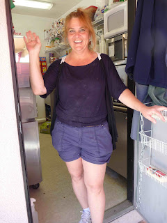
| These nice folks took my picture. He works for Rockwell and spent some time in Ontario working in Cambridge. He has two Harleys. |
 |
| This one's for you Gerry. Milton HOG patch and rocker on display |
After leaving Santa Barbara, any time the road passes by a
beach, there is a continuous line of parked cars at the edge of the highway,
with surfboards sticking out the backs of trucks. That real “Beach Boys” feel. (Note to any motorcyclists doing this trip –
be careful and avoid the right lane – cars regularly jump out to get back on
the highway. Very dangerous!)
Highway 1 took me through Santa Barbara, Ventura, Oxnard,
Malibu and eventually into Santa Monica.
Malibu was pretty interesting. There are lots of houses crowding the beach
and many in the hills. I suppose there
are some large properties for the mega movie stars but most waterfront
properties are actually pretty crowded.
While the water side of your house would be marvelous, it would not be
unlike having your front door 20 feet from Dundas Street in Oakville/Burlington
with probably more traffic. Getting in
and out of your house would be a major chore, not to mention the noise! I honestly don’t think I would want a place
there (unless I had one of the gazillionaires places of course.)
I followed the traffic all the way to Santa Monica hoping to
get a picture at the pier. Man, the
place has changed since I was there last and there’s lots of construction going
on. I got one quick picture and got out
of the traffic.
 |
| At the Santa Monica pier. My last look at the Pacific before heading east. |
 |
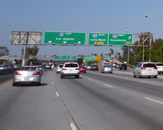
| The ugliness of heading east. I think I liked the coast better. |
Tonight is urban camping in the suburb of Pomona.
Las Vegas tomorrow.


Great beach view! Good thing you're stopping the coast in LA, Tam and I did San Diego - LA and it's mostly built up & a bit disappointing.
ReplyDeleteDo you hand out SUPER DAVE business cards with the Blog address so that all these people you're taking photos of can see themselves made famous?
DougD
No business cards but sometimes I tell them they can google SuperDaves epic blog! Sometime I don't!
ReplyDeleteDave - Its a well known fact....
ReplyDeleteZzyzx, California ( /ˈzaɪzɨk/), formerly Camp Soda and Soda Springs, is a settlement in San Bernardino County, California. It is the former site of the Zzyzx Mineral Springs and Health Spa[1] and now the site of the Desert Studies Center. The site is also the location of Lake Tuendae, originally part of the spa, and now a refuge habitat of the endangered Mohave tui chub.
Zzyzx Road is a 4.5-mile (7.2 km) long, part paved and part dirt, rural collector road in the Mojave Desert. It runs from Interstate 15 generally south to the Zzyzx settlement.
The settlement is in area code 760 and ZIP code 92309. The nearest town is Baker, California, 7 miles (11 km) north on I-15. Las Vegas, Nevada is the nearest major city, about 100 miles (160 km) northeast.
Thanks Cliff... I mean Alex!
ReplyDelete